
According to four hundred something important persons assembled for the city's annual Everybody Look The Fuck Out press conference, the 2019 hurricane season is supposed to be an "average" one. Which is to say, it's probably bad.
Ben Schott, the meteorologist who heads the National Weather Service office in Slidell, said this hurricane season — June 1 through Nov. 30 — is predicted to be an “average season.” However, he urged residents to make a plan should a storm hit the city.But before we can get our heads around the average shitty summer we still have to deal with the above average shittiness of this spring.
“It only takes one,” he said, a sentiment echoed by several other speakers.
LITTLE ROCK, Ark. - Crews were making a “last ditch effort” Saturday (June 1) to save low-lying parts of a small Arkansas city from floodwaters pouring through a breached levee. Downstream, authorities warned people to leave a neighborhood that sits across the swollen river from the state capital.The Arkansas breach comes as the Corps of Engineers makes last minute changes to its plan to open the Morganza Spillway. They were going to do it tomorrow but decided instead to wait until Thursday. Likely the public feedback had something to do with that. Farmers, fishers and residents in the Atchafalaya basin are rightfully concerned about all that fresh water that's "not so fresh." Still, it's a tight needle to thread. I mean, yikes!
The Arkansas River, which has been flooding communities for more than a week, tore a 40-foot hole Friday in a levee in Dardanelle, a city of about 4,700 people roughly 100 miles upstream from Little Rock. On Saturday, Mayor Jimmy Witt said officials don’t think a temporary levee being constructed will stop the water from flooding the south side of Dardanelle, but he hopes it will buy time for residents of as many as 800 threatened homes to prepare.
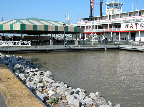
The Baton Rouge Police Department shared bird’s-eye view images Thursday night (May 30) showing the swollen Mississippi River encroaching on the levee near LSU’s campus. The agency posted the photos the same day President Donald Trump declared an emergency in Louisiana allowing for federal assistance for those impacted by river flooding in certain parishes.It's very high.

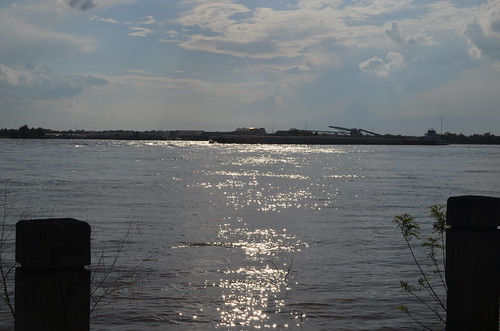
On Friday I took a ride downtown to look at the high river in the Quarter. It's very high.

But it's not scary high. Not in the way those Baton Rouge pictures are. It's actually a little bit lower than it was in 2011 which was the last time we were this skeeved out by it. Here's basically the same location then.
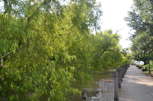
Of course the Bonnet Carre has been open (for the second time this year) a few weeks so, we had better hope the water is under control to some degree down here. I also rode up to The Fly on Friday just to see it all. It's very high. But not scary high.

That's not going to stop anyone from worrying about all sorts of things.
There’s been little research into the likely effects of a significant storm while the Mississippi is near its flood stage, in part because the river’s level usually begins to drop from its swollen spring state well before strong hurricanes typically develop.Welcome to the shitty season.
This year, however, the river is expected to remain at 16 feet above sea level at New Orleans’ Carrollton gauge, just a yard or so below the lowest points of the river levees, well into the summer.
As climate change pushes rainfall totals higher across the United States, prompting earlier and more severe storms, some observers are calling for more study of how serious a threat such a scenario could pose going forward.
No comments:
Post a Comment